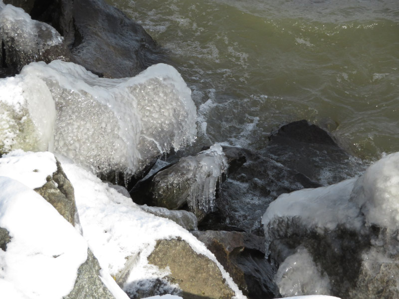
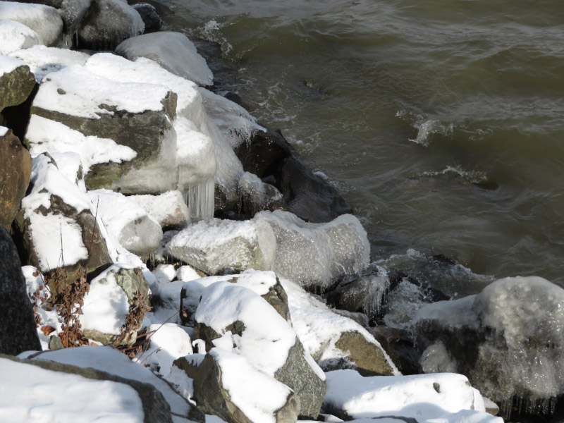
HoLLIE – week 2

The second HoLLIE (Howard County Legacy Leadership for the Environment) class day was last week and it was held at NASA Goddard. I was worried about hitting rush hour traffic so left very early since we were to meet in the Goddard Visitor Center parking lot to catch the bus into the facility. The day was sunny and clear…but very cold and breezy. I managed to take this picture of the visitor center (not yet open) without getting out of my car!

20180208_073546.jpg

The theme for the day was “what informed citizens need to know about earth systems science.” It was the first of two days that our classes will be at Goddard; last week we started with lectures on “understanding the tools and the state of the art in earth science” from the Project Scientist for the AQUA satellite and then got a tour of mission control for several earth science satellites from the Aqua Mission Director. They did a good job of demonstrating the types of data that can be collected, the methods used to collect it, and the ways it has been analyzed. I was surprised to see the LRO (Lunar Reconnaissance Orbiter) mission control in the same building. That brought back the memory of my daughter being on the team to do image calibration shortly after it launched during her undergraduate days!

20180208_121831.jpg

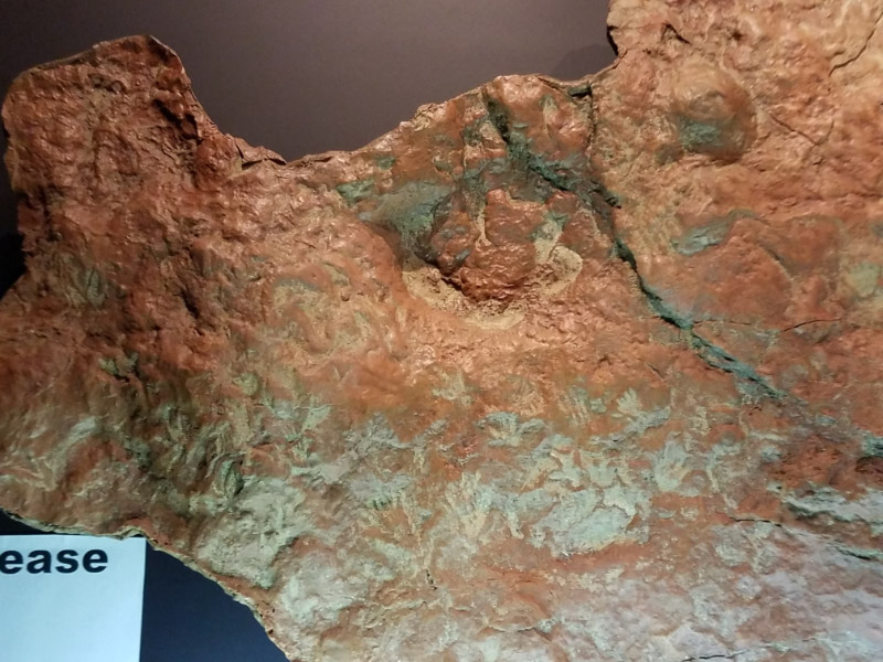
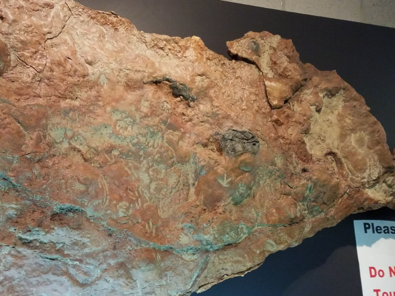
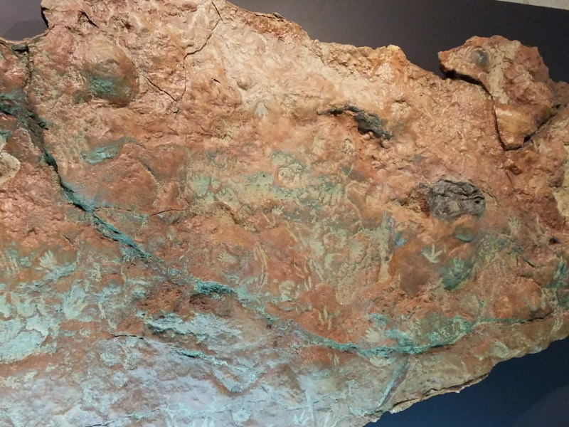
On the way back to our classroom, we stopped by the replica of the big rock found at Goddard that has mammal and dinosaur and mammal tracks. This was not on our agenda originally but was a wonderful serendipity aspect to the day even if it took part of our lunch time. I’d read about it in one of my news feeds and followed the link to the paper…but it was such a thrill to see the exhibit and hear the short lecture. I managed to take a few pictures.

We started the lectures on ‘understanding the science of earth’s cycles’ that will continue in this week’s class. We talked about the oceans and the carbon system in this second class. One of the interesting videos in the lectures is available online: twenty years of global biosphere data mapped on a slowly spinning globe; it easy to see the annual cycles. With the massive amounts of data, visualization becomes an important component.

20180208_120511.jpg

When I got home an article in one of my newsfeeds talked about climate models that are developing that explain why there might be a linkage between melting of Arctic sea ice (one of the topics for the HoLLIE lectures this week) and droughts in California (How nuclear weapons research revealed new climate threats). It was easier to understand since I had the background of the lectures!

Previous HoLLIE posts: Week 1

Icy Day

Earlier this week we had about 24 hours of icy coated trees (and streets were impacted enough that schools closed for the whole day). I was glad I had no reason I had to be out and about; I could enjoy the ice through the windows of the house – or open doors to get a clearer picture. I noticed how different the types of trees looked with the ice. The pines droop over very quickly from the added weight of ice coating their needles. The tulip poplars develop little icicles on their more horizontal branches, but the seed pods didn’t seem to accumulate any ice.

2018 02 IMG_8379.jpg

When I first looked at the maple, I thought it hadn’t accumulated ice as much as the other trees. When I zoomed in with my camera I saw that it did have ice accumulation and the buds were already dark red. I don’t think the buds will be damaged by the ice since they are still closed.

2018 02 IMG_8383.jpg

The sycamore had a thin coating of ice and longer icicles. I was surprised that the lone seed ball from last summer does not appear to have ice on it!

2018 02 IMG_8398.jpg

I worried the most about the plum tree in our front yard. It has a lot of small branches that are almost horizontal and tends to be coated with ice rather than icicles forming. It glistened in the morning sun (that didn’t cause very much melting because it was so cold).  Fortunately, there was very little breeze so I don’t see any breakage.

2018 02 IMG_8388.jpg
2018 02 IMG_8400.jpg

Zooming – January 2018

I’ve been at home observing birds a lot during January and my camera works as well as binoculars for me…so why not go ahead and take the picture too! My favorite is probably of the flicker – savoring the drink of water from our birdbath.

There were some other reasons to use the camera’s zoom – the full moon in early January (there will be another one the last day of the month),

2018 01 IMG_7425.jpg

Ice crystals in a stream (better to use the zoom than making a mistake – taking a very cold step),

2018 01 IMG_7590.jpg

A stump that was on a slope of boulders (to hard to get close), and

2018 01 IMG_7930.jpg

In camera cropping of the morning light on the trees behind our house.

2018 01 IMG_8041.jpg

It was a good month with my Canon Powershot SX730 HS with 40x Optical Zoom!

Conowingo in January – part 2

The day we went to Conowingo was part of a warming trend – but it was still cold enough that ice coated any wet surfaces. The fishing pier was gated off and there were signs saying there would be no fishing because of a toxic spill…so the ice forming from the spray on the railings was undisturbed.

Further out in the water – any rocks or small trees near or in the water because a framework for ice formation.

2018 01 IMG_7783.jpg

The rocks along the back were coated. Very little of the ice was totally smooth. It hung in icicles and knotted into pebbly textures that looked a little like bubble wrap!

I was glad that the day was sunny and relatively calm; my winter gear did a good job of keeping me comfortably warm. We stopped for lunch on the way home. Next time we’ll go earlier to (hopefully) see more of the eagles while they are still hungry for breakfast! I wondered where the Great Blue Herons were since we usually see a few of them. Both the herons and eagles will start their nesting cycle soon.

Icy Stream

At mid-week, I hiked down to the stream restoration area at Mt. Pleasant. The day was a little warmer than many of our recent days and there was very little wind. I dressed for the weather and didn’t get chilled. There has been enough rain that the ox bow portion had water/ice in it. The trees that were extracted during the restoration and repositioned in the stream to upside to down as habitat were indicated how high the water has gotten since the restoration reconnected the stream with its flood plain. The stumps have not been completely covered but the water has gotten a few feet higher than it is now.

2018 01 IMG_7562.jpg
2018 01 IMG_7571.jpg

Further along the stream a smaller stream – frozen – cascades over rocks.

Some ice had broken free with the melting and turned over – showing frost crystals…bubbles…smooth contours. It looked like a chunk of clear glass.

I liked the leaves held in place my ice on the flowing water; they added color.

2018 01 IMG_7577.jpg

The water level had gone down since this ice froze. It was a shelf above the flowing water. Based on the sediment on top of the ice, it is older and may have had sediment laden water flowing over it briefly.

2018 01 IMG_7581.jpg
2018 01 IMG_7583.jpg

The beach area that used to be mostly small pebbles and sand, has had large rocks since the Ellicott City flood before the restoration project and then additional rocks were added during the restoration. It makes it harder to walk in the middle of the stream…but better habitat.

One area had conditions just right for forming crystals…a favorite photography target for me.

As we started back up the hill, I noticed a battered lichen on some of the rocks.  After all the clear ice, the bit of color caught my attention!

2018 01 IMG_7595.jpg