Patuxent River
/My husband and I enjoyed the PAXCON Reflections (the webinars provided in lieu of the Patuxent River Conference this year). The recordings are now posted to the website (link above) and available to all. The topics include:
How climate is changing in the Chesapeake Bay region and the Patuxent River watershed, potential impacts to Patuxent River water quality, and how communities can prepare for the future
The importance of wetlands in the Chesapeake Bay Region
Stormwater and how local communities are working to restore their streams and meet regulatory requirements
I’ve been prompted by these webinars to think about my own connection to the Patuxent River close to where I live. The Middle Patuxent originates in Howard County and joins the Little Patuxent near Savage, MD which continues southeast to join the Patuxent River just before it crosses under Crain Highway just south of Crofton, MD. There are 5 locations where I’ve been at or in the Middle Patuxent in recent years. The first 4 are sites for volunteer gigs (pre-pandemic) with high school students assessing water quality. Use the Google Map starting at MPEA and follow the Middle Patuxent.
MPEA
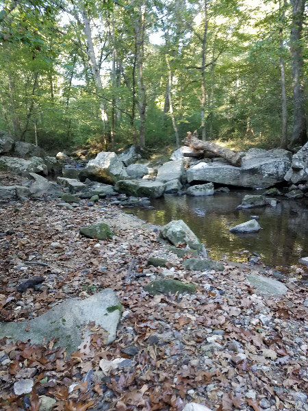
Middle Patuxent Environmental Area is near the origin of the Middle Patuxent. There are several streams that come together in the area to form the river. A loop of the Southwind Trail that goes close to the river. There are a lot of rocks in and along the river…riffles and runs and pools…places for lots of critters.
One time I went down when it was raining – the trail too muddy and the river too high for the water quality sampling. The runoff water had some foam in it and the speed of the water demonstrated how the banks eroded with each such event (note the leaning tree at the edge of the water.)
Robinson Nature Center
Robinson Nature Center is a little further down river from MPEA. I did water quality monitoring with other adults at that location pre-pandemic. There is more water in the channel than at MPEA. The trees along the river are smaller and don’t shade the water…making the water warmer that it was prior to the surrounding development. The banks are somewhat incised but there are still some beach areas…riffles, pools, and runs. There is more silt as well. There are still a few big rocks in the river. Note the whale shaped rock!
Edenbrook
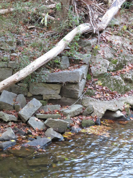
The Middle Patuxent flows under Columbia Pike and on through suburbia. Parking at the dead end of Edenbrook Drive near Kings Contrivance and walking down the old road (gated) to the river is another access point. There use to be a bridge over the river that connected to Kindler Road on the south side. It washed away years ago, but the abutments are still along the river. The banks are more incised. The river is disconnected from its flood plain by this point (it has cut a deep enough channel that it doesn’t broaden much even when there is a lot of water: the water just flows faster and the channel just gets deeper).
Sweet Hours Way
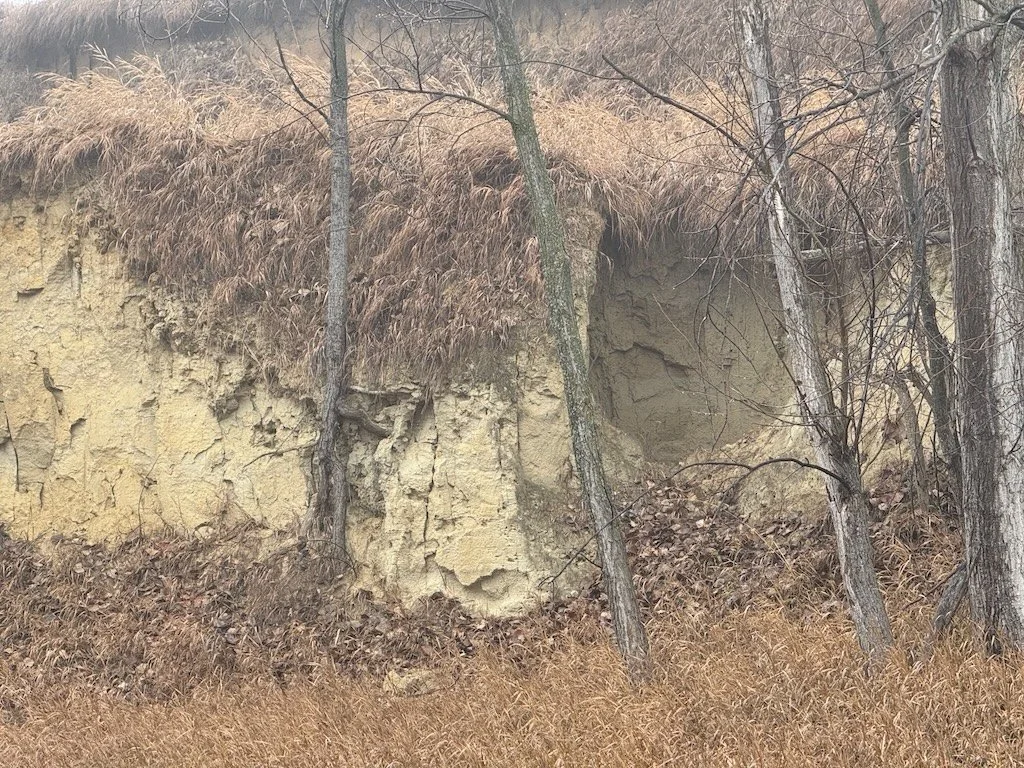
Parking on Sweet Hours Way and taking the Kings Contrivance Loop trail down to the rive is a little scenic hike on a paved. The banks are much more heavily incised here. The paths from the trail down to the river bed are very steep. There are trees that lean over the river in some places but some of them are barely attached to the bank. Once they fall, the stabilization they provided will be gone and the bank will collapse…until another tree’s roots hold the soil.
There are stretches of the river here that are sand/silt; the rocky bottom has been covered over.
The little streams that flow down to the river here are also incising their banks. The land is sloped, and the banks quickly erode when they don’t support enough vegetation.
Behind my house
I hiked down to Middle Patuxent behind my house last spring during the first wave of the pandemic. Trees have fallen into the river – probably during a wind/rain event. They were big enough that they would have been growing at the river’s edge when my daughter was young (over 20 years ago) and we tried to make boats from sycamore bark on one trip to the river. During big rains, the water accumulates and runs off more rapidly now than it did then. There is forest buffer along the river but there has been a lot of development (impervious surface) in the watershed between MPEA and my neighborhood. Some development is much closer to the river than my neighborhood with is about 0.13 miles from the river (forested). Some roads closely parallel the riverbed.
I don’t know the river beyond that point although I might decide to take a small field trip to the Savage Mill/Bollman Iron Truss Bridge to look at the area where the Middle Patuxent merges with the Little Patuxent. I walked in the area years ago…but it was before I started taking pictures.

